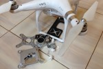
Now that I have had my DJI Phantom 3 Advanced quadcopter for a few weeks now, I figured I would share my first bunch of bush flying drone photos with you all. They say if you own a drone, expect to crash it at some point, most probably into a tree or a lake. I can now confirm this is entirely true as the photos below testify to, following an incompatible tree/drone interaction. Luckily spares are available for almost every part of the Phantom 3 although I opted for a backup replacement drone.
I am slowly getting the hang of it now and I am loving the new angles it is allowing me to get photos from. I am also shooting a fair bit of video too, so expect some of that to feature in my upcoming short film. In the mean time, here’s some photos and a few words to go with some them. Enjoy!
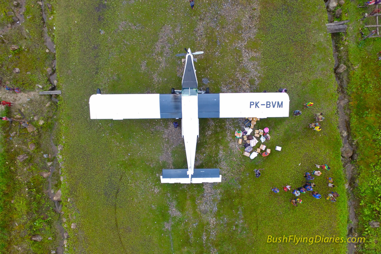
The Phantom 3 climbs at an amazing rate and is able to shoot directly downwards giving some rather unique views of the world below. I reckon this view shows just how simple the Porter’s design is with its tapering nose and tail along with straight, slab wings. Simple but effective.
Now this view gives you an impression of quite how steep some of the airstrips are here in Papua. Whilst the camera has made it look steeper than in reality, the view from the cockpit as you roll over the edge for take-off is pretty similar and certainly gets the old heart pumping!
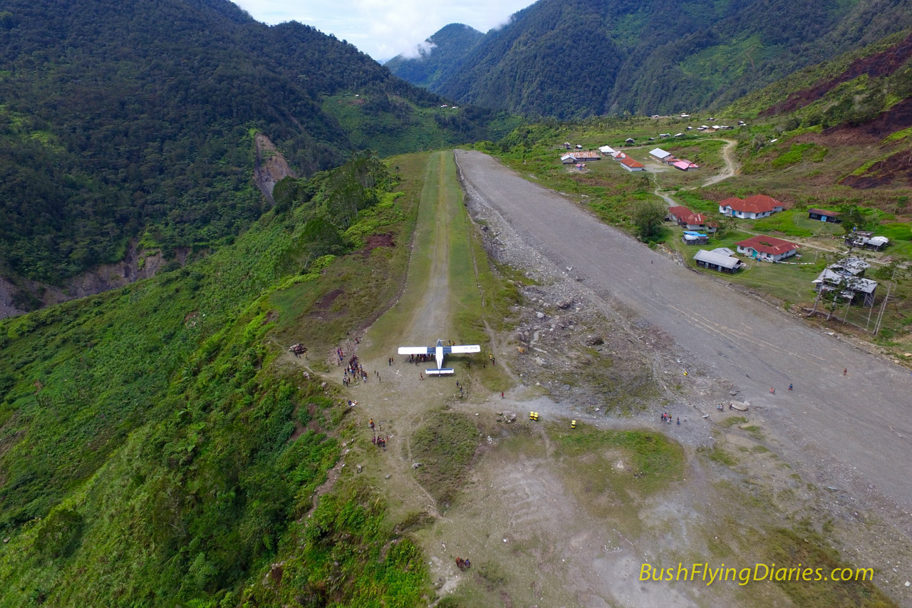
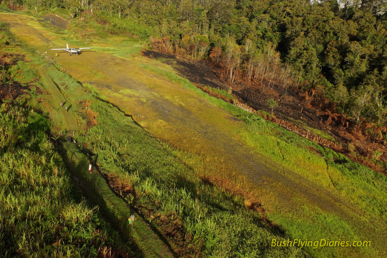
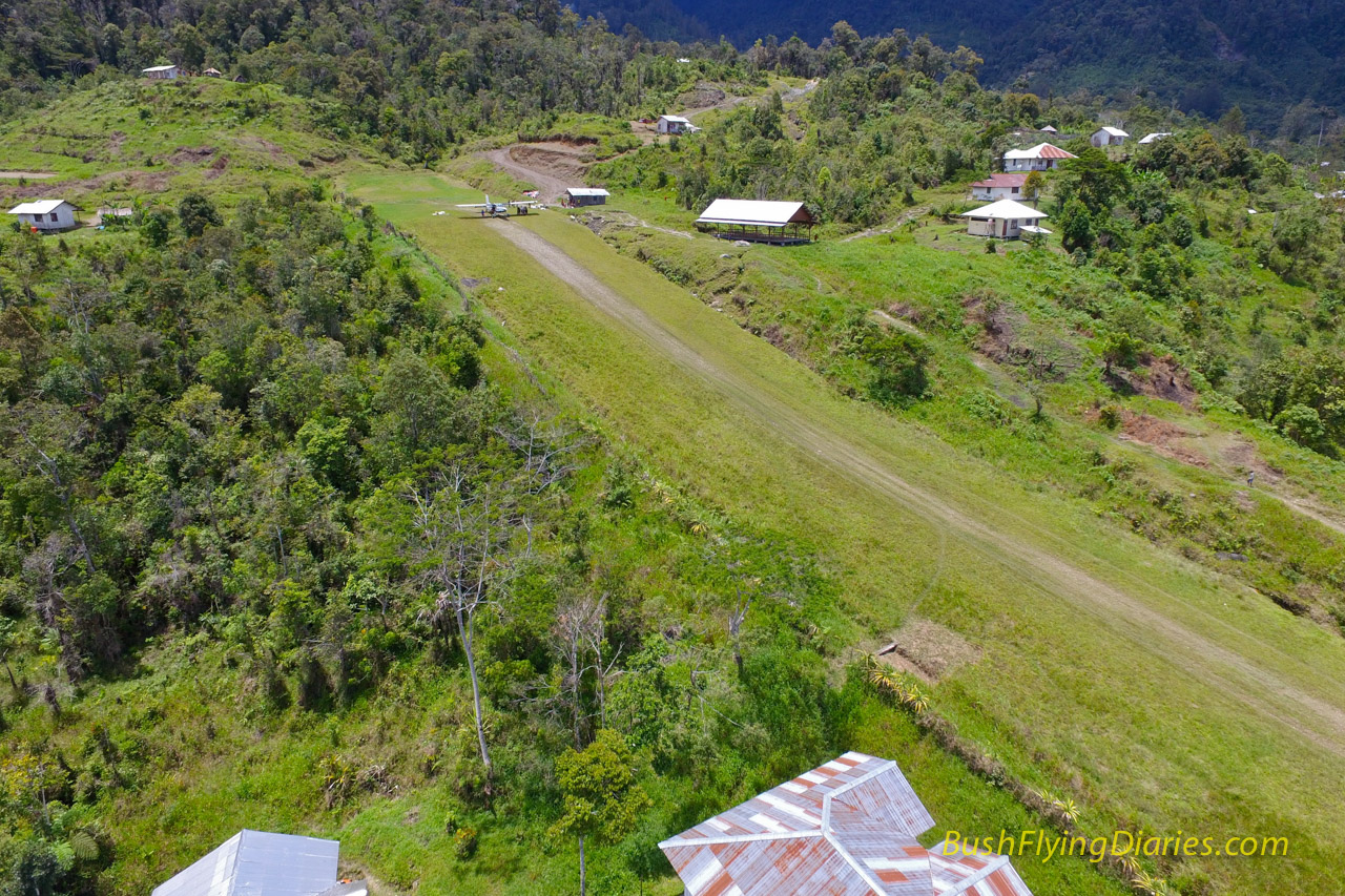
Mapnduma has never looked that challenging before but hopefully this view shows its 400m of flat, slippery airstrip in a new light. When wet and with a bit of a tailwind this can be quite a tricky airstrip to land on and keep the aircraft in the centre before stopping before the end.
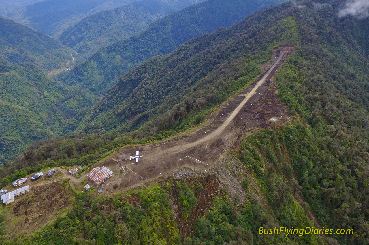
Always a dramatic looking airstrip, perched as it is on a 6500ft high ridge, I love this view of Tsinga. I might try a few more angles next time I am up there and try to get Puncak Jaya mountain in the background too.
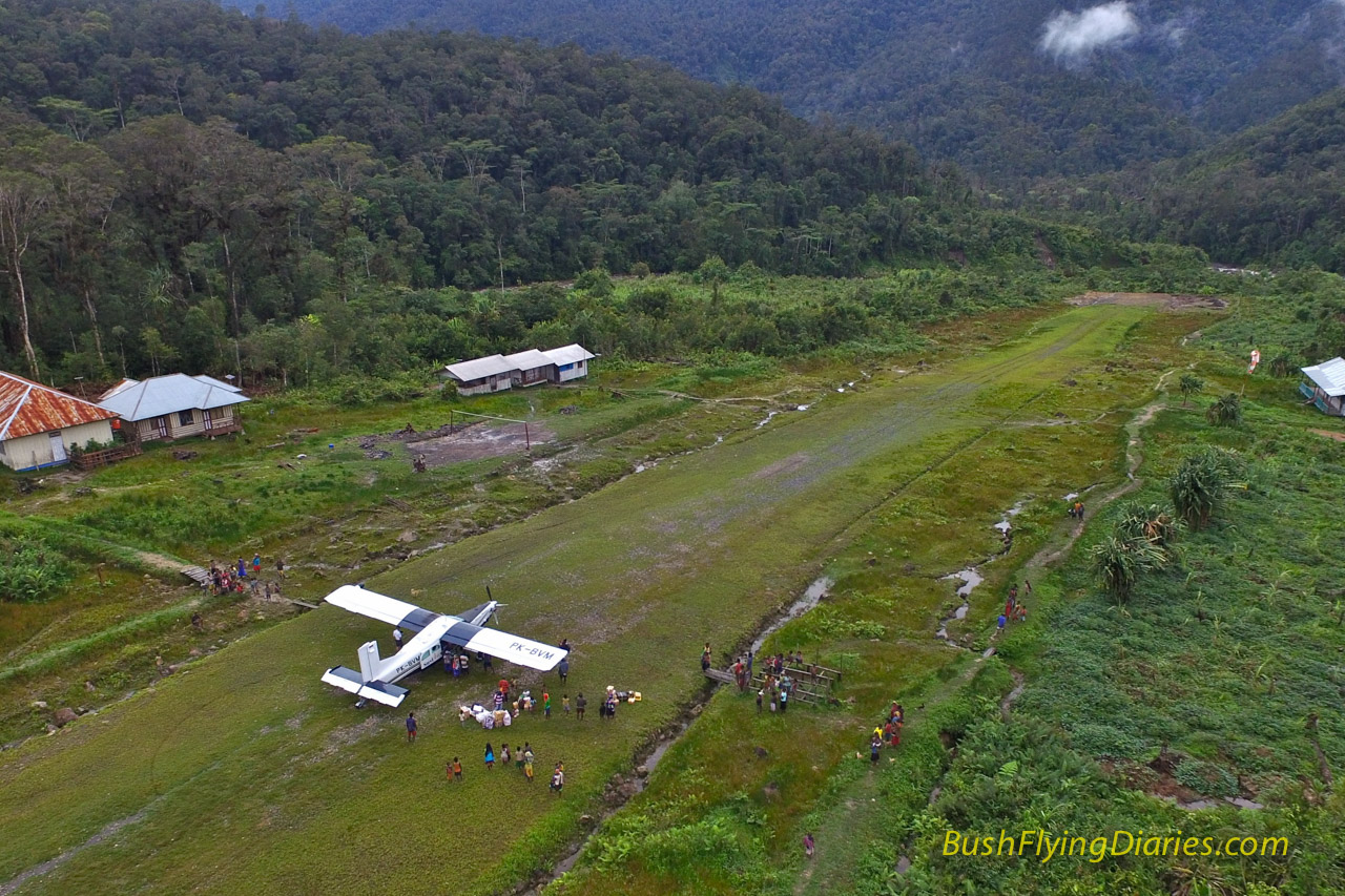
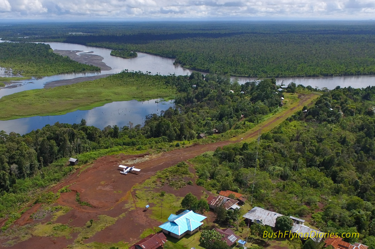
Finally a view of Kilmit showing the departure path. As you can see, in order to take-off from here you need to make an immediate left turn and follow the river along the valley floor as you climb out of it. Oh and it’s only 300m long. I’m not sure the passengers enjoy it as much as I do however!
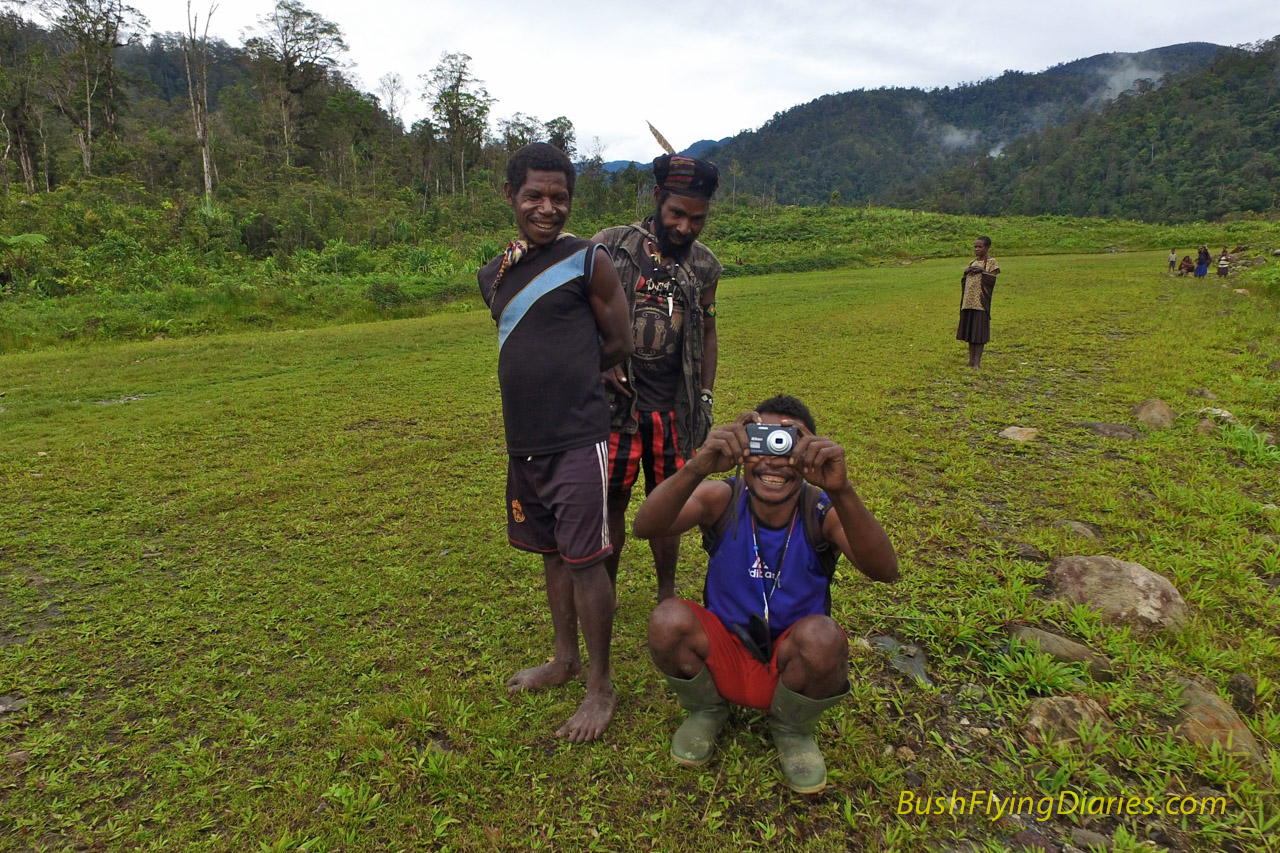
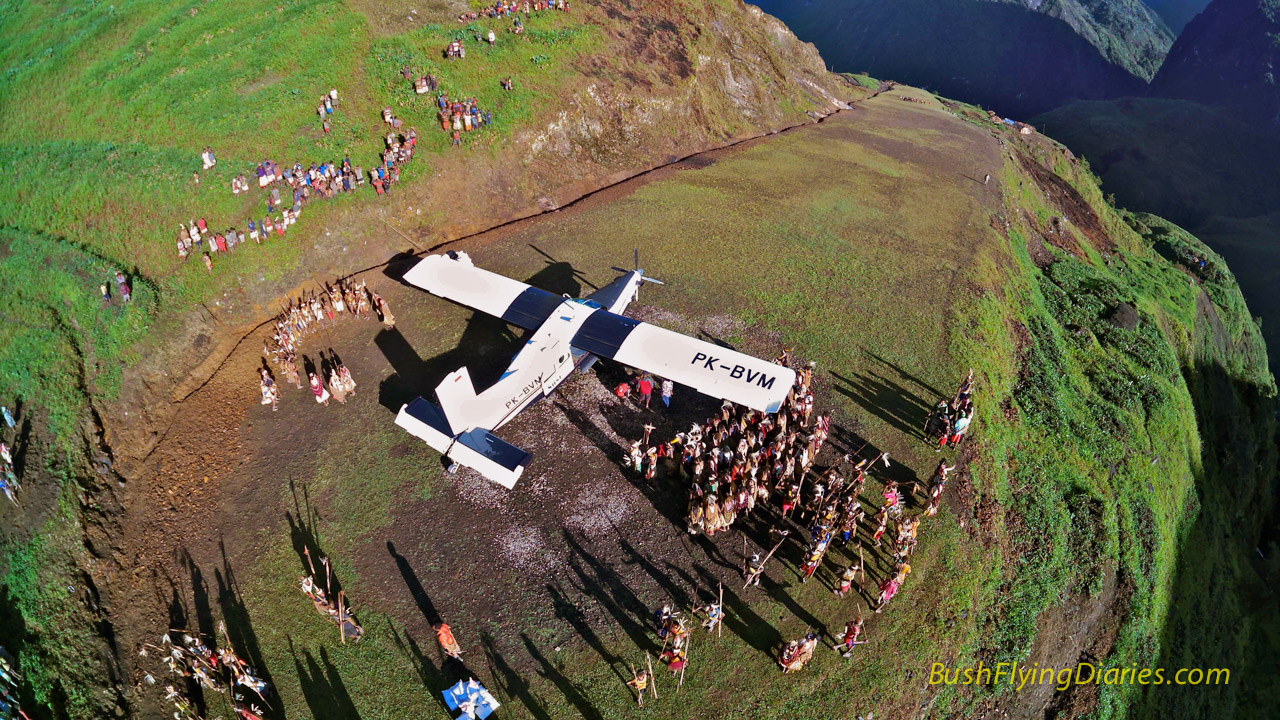
I was expecting the local people of Papua to be rather freaked out by a remote controlled flying machine buzzing about their villages but I guess when you show up in a much larger flying machine, a tiny drone isn’t as freaky as you might expect. Mostly the locals seem to really enjoy it and the kids love chasing it around (until it chases them back!).
The colours of the morning sunshine really show up beautifully on the Phantom’s camera. This is straight from it without any tweaking other than to resize for this blog. Awesome!
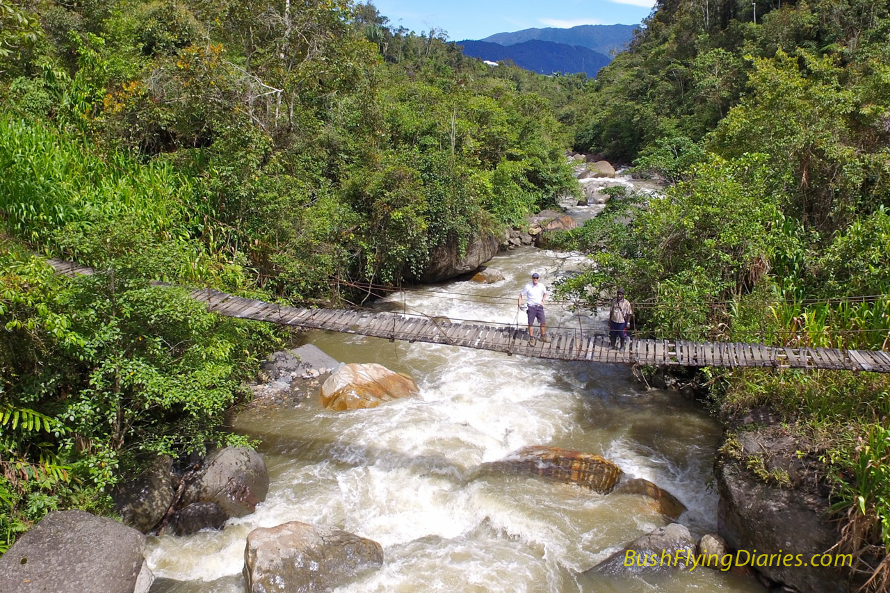
Of course it is not all about crazy airstrips. There are plenty of other fun things to take photos of here in Papua. This is the bridge that links the village of Jila with their airstrip. The chap standing next to me said the bridge should only be used one at a time; and then joined me on the bridge..
King of the hill – the Porter sits atop the 18% slope of Doufu airstrip in the northern flat lands of Papua. Taking a photo from below or at the same level as the top of a slope really give you an idea of the steepness.
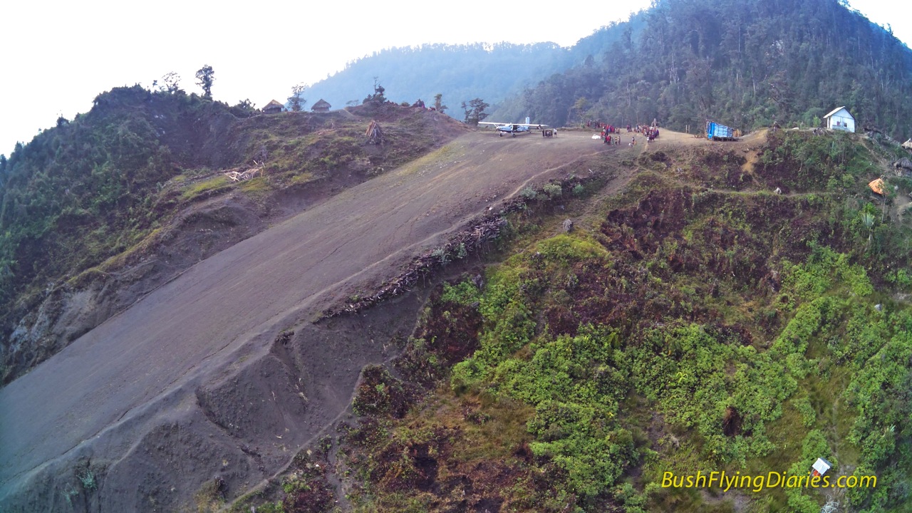
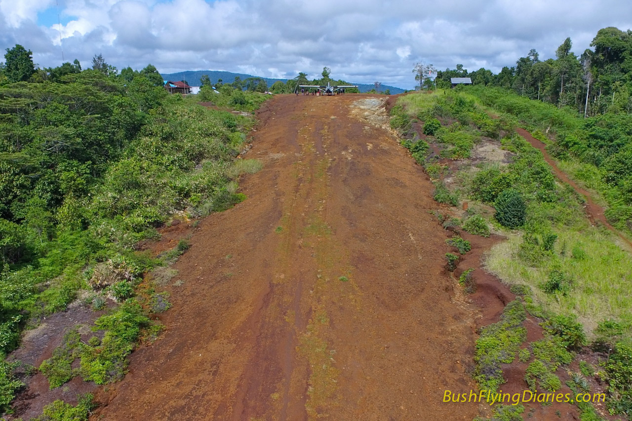
Ok I’ve already posted this last one on social media to much discussion. Yes the top part of the airstrip at Wipon is steep but perhaps this angle exaggerates it a bit. I have yet to measure it but it is probably around 23% or so whilst the whole length averages around 17-18%. That is still pretty steep however and makes for a pretty short take-off roll, even at 8000ft.
Discover more from Matt Dearden
Subscribe to get the latest posts sent to your email.
I think you’ve made the right path for your career/life. These photos and words make a lot of us jealous and I wish you all the luck for your adventurous life.
Cheers mate!
Wow!
Luarbiasa..airstrip,view, and the drone..perfect.
Amazing! Amazing! Both you and the drone are doing a great job!
Keep the amazing pics coming!
Matt, Thanks again for your trouble in producing the great flying, writing, pix and videos that allow us a peek into your world. Those tricky-looking mudways seem so treacherous and worrisome, but you look to be so calm and confident. Please be safe. 3Green, cb
what you do is a great testimony to your skills and experience but even then anything can creep up. Here’s to safe flights all to the end of your career. great work!
They hiring ?
Yes: http://www.susiair.com/career
Nice Pics. And yes, the slope on the last one is pretty impressive 🙂