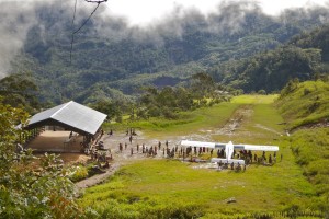
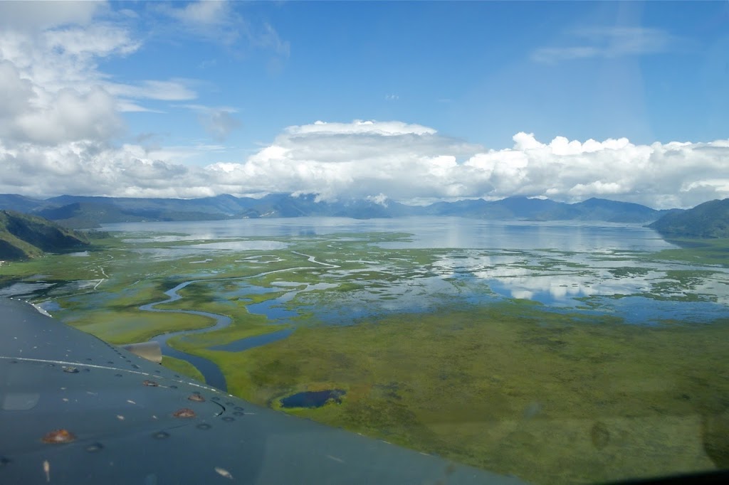
It’s been yet another wet week out here in the mountains of Papua with some places getting more than their fair share of water. Enarotaili is one such place located at 5500ft in the Paniai district of Papua on the banks of Lake Paniai which is by far the largest body of freshwater in Papua. It’s a beautiful sight from the air and you have to double check your altimeter to realise you really are flying over such huge body of water at such an altitude.
 |
| Lake Paniai, Paniai district, Papua |
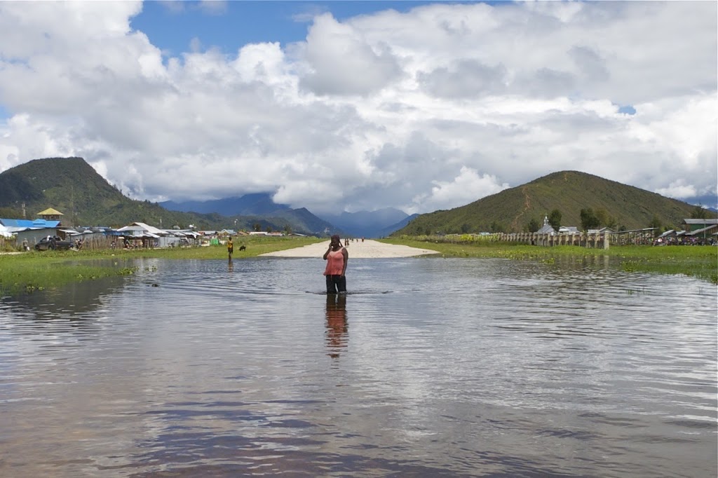
As the flood waters have begun to encroach on the runway at Enarotaili, I wanted to take a walk to the threshold and check out just how deep the waters were getting. So, boots off, I started walking.
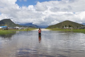 |
| Flood waters at the beginning of Enarotaili’s runway |
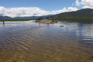
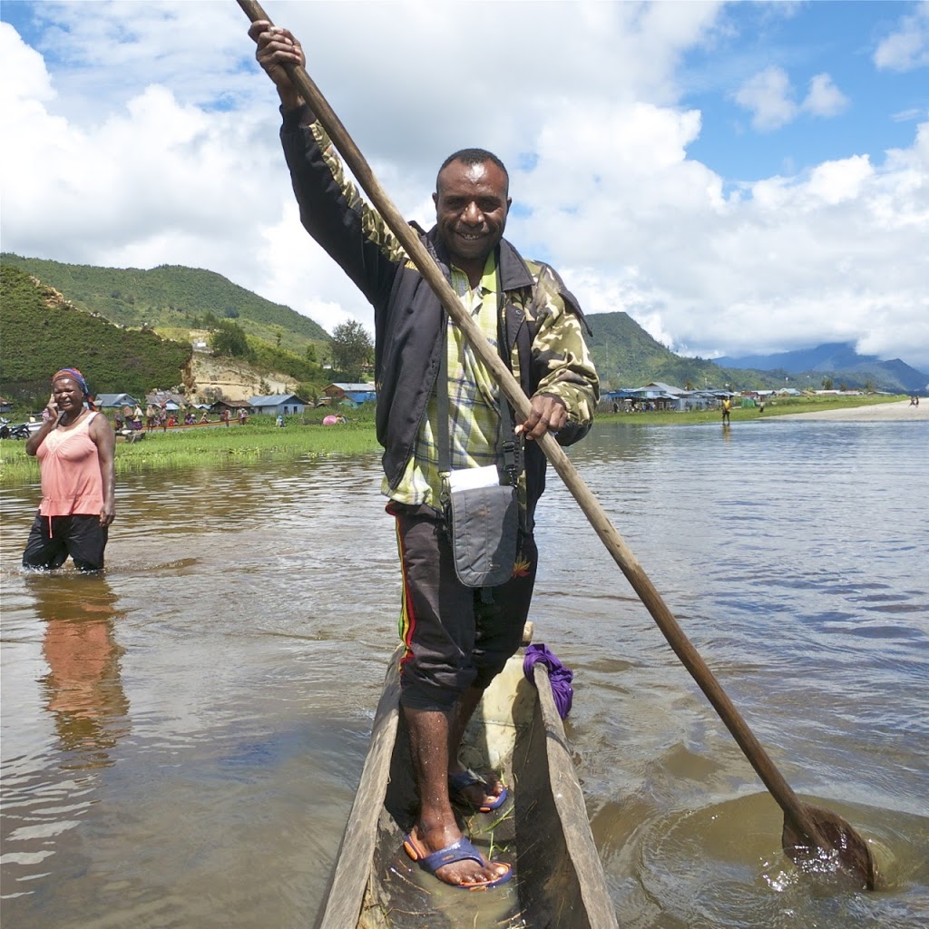
However, the water level was a fair bit deeper than it looks in the above photo due to it being crystal clear and having waded up to my knees, I then had to make use of a small canoe to get all the way to the beginning of the runway and the small road that runs perpendicular to it. You certainly wouldn’t want to try landing on the threshold as that was about 2ft underwater. Not being a float-plane pilot, it’s quite a new concept to have to watch for boats on the runway as I flare for the landing…
 |
| Jerri paddling us to the beginning of the runway at Enarotaili, Papua |
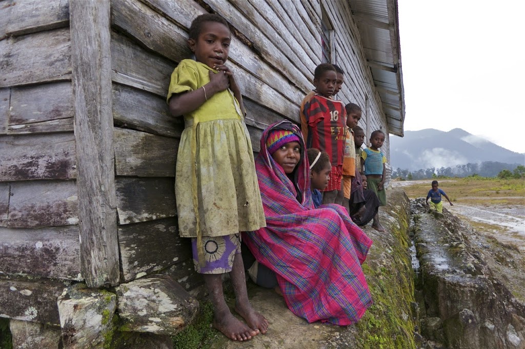
The small road that runs perpendicular to the runway, just before the threshold, links Enarotaili to the outlying villages to the north which have now been cut off by the rising water levels. Boats have always been used around these parts, with it’s many water ways, but cars and especially motorbikes are also commonly used. For the time being, they’ve become redundant. The rising water levels have also claimed a number of houses along the north eastern side of the runway and they now sit mostly underwater being only a single story high.
 |
| Road leading out from Enarotaili to the northern villages |
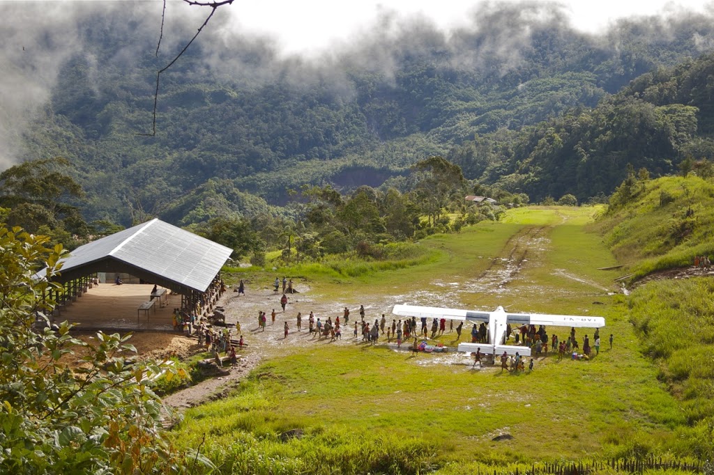
Of course Enarotaili’s not the only place that’s been getting a lot of rain and some airstrips have been cut off for a couple of weeks now. I finally managed to get into Modio after well over two weeks of trying. The valley it’s located in has been under a constant rain cloud for all that time in the mornings, so we’ve not been able to get in there to delivery the rice supplies. Deneode is another such airstrip that’s been suffering thanks to being located on a ridge that’s been sitting in the clouds for nearly as long. But if you wait long enough, a gap in the weather will eventually appear on one of the mornings. The one advantage we have with the rice loads is that if you can’t land at the assigned destination, you can drop it off somewhere else nearby rather than having to RTB (return to base).
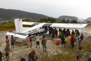 |
| Villagers sheltering from the rain under the wings at Deneode, Papua |
 |
| Deneode locals taking shelter from the rain |
The biggest concern with all the rain, aside from flying in clouds a lot, is the condition of the airstrips we go to. I’d already decided not to go back to Kegata for the time being, following a pretty hairy departure the other week and prior to that the previous pilot based out of Nabire mentioned a couple of places he’d not be going until things dry out. This sharing of information is vital to preventing incidents and is something we all actively do when swapping out after a tour.
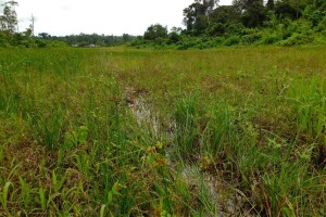 |
| Standing water hiding in the long grass at Bidau, Papua |
 |
| A wet and muddy Apowo airstrip, Papua |
I’m now back in Timika for a few days before my next holiday and from chatting to the pilot I’ve replaced, Timika has been having even worst weather than Nabire with almost constant rain and low clouds most mornings. It’s reckoned to continue throughout the month so I guess I’ll be getting plenty of IMC flying practice in!


The Apowo strip pretty much reminds me of Lukla airport in Nepal.
Cheers for the comment! I really should go check out this Lukla airport that everyone seems to mention any time I post a photo of a typical airstrip here in Papua. Not sure it’ll compare in reality though ;o)
Hi Matt, excellent blog. I really enjoy reading about your adventures so keep em coming! I envy your job very much, they actually pay you for that? I spent some time ag flying in a DHC-2 Beaver many years ago, the terrain was not quite as challenging though. How does a normal day go? Depart with full fuel and do as much flying as possible or is it a bit more structured than that? Thanks again & stay safe.
Cheers! And yes they do seem to be paying me for this ;o)
A normal day will involve taking a load (pax and/or cargo) from a main hub (Timika, Nabire etc) into a mountain airstrip then returning back to the main hub. If no pax from that remote airstrip, we can drop in somewhere else on the way back and see if there’s any pax there. This is repeated 4-5 times until the afternoon when we tend to stop flying as the weather starts to get nasty then. So there is a sort of structure to the day!
Hi Matt, what an excellent blog. Can you provide me information for Apowo airstrip such runway heading, runway wide/length, elevation and gps coordinate? I’ve been working a scenery pack of Dangerous airports in Papua – Indonesia for MS Flight Simulator X. Thank you.
Sure! Apowo is aligned 23/05 with landing on 23 and departing on 05. It is 400m long and about 21m wide with the threshold at 4900ft and a 12% upslope. Coors are: 04º 2.7500′ S 135º 33.5001′ E Hope this helps!
This is very useful, Matt. Many thanks for the information.