 |
| Current photo of Beoga, looking down runway 34 |
Runway statistics
Orientation: 16/34 (Landing 16, take-off 34)
Length: 570m
Elevation: 5600ft
Slope: 12%
Surface: compacted gravel
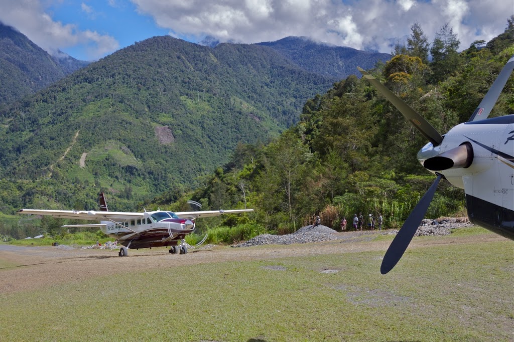 |
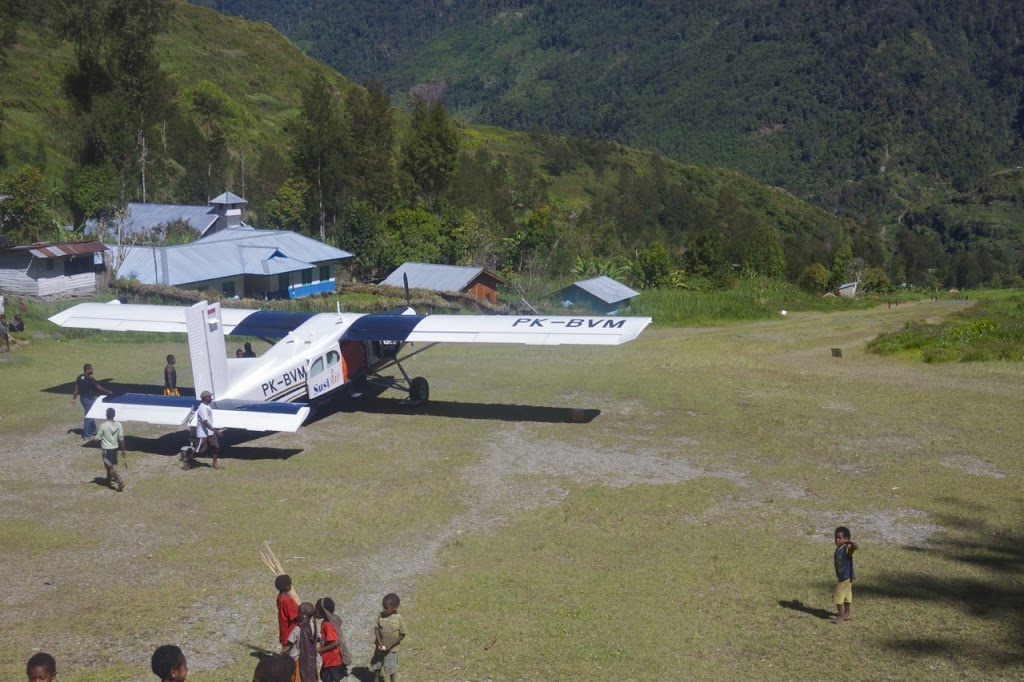
| Cessna C208 Caravan taxiing in after landing at Beoga |
Pilot notes
Beoga is located in a short, narrow valley branching off to the south of a much longer valley running east-west. A typical approach from Timika brings you into this larger valley at the western end which can safely be descended into to join a right-base for Beoga (a right-base join is like arriving at a runway at ninety degrees to the final landing direction with a right turn required just before landing).
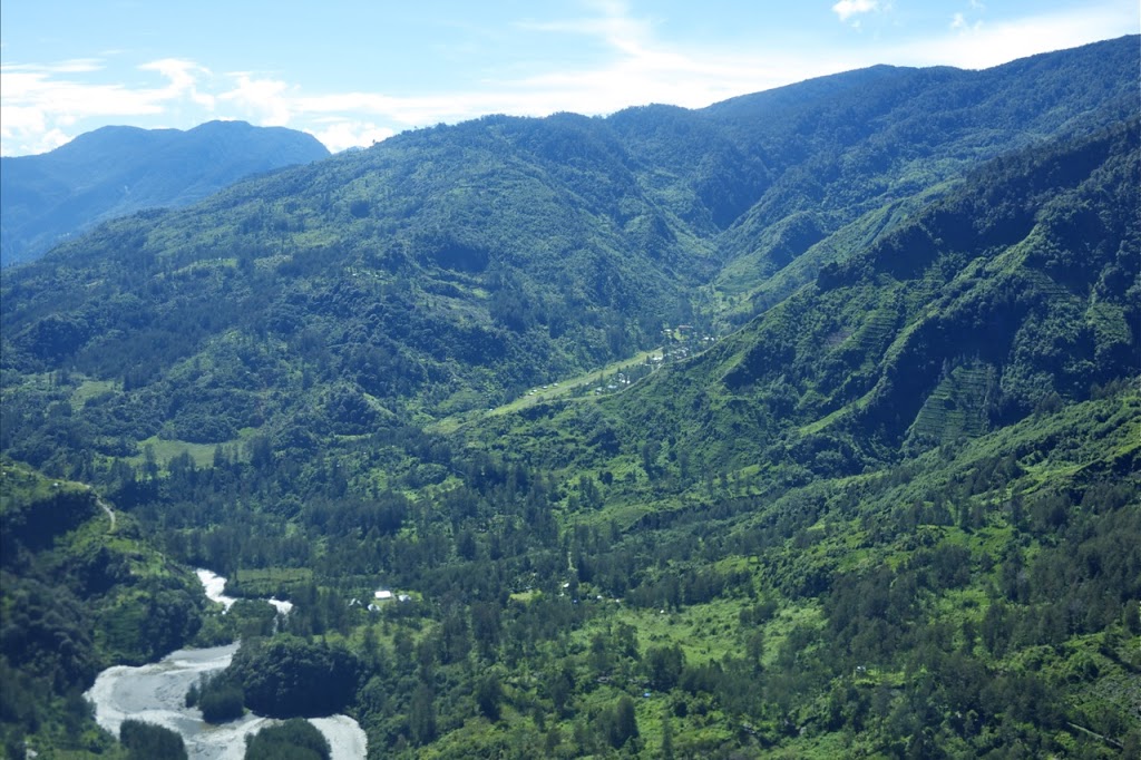 |
| Joining right-base 34 at Beoga |
Like Wangbe, the weather around Beoga is very typical of mountain weather. The mornings often feature low lying fog but no winds. As the morning progresses, the fog burns away and the wind starts to pick up, along with cumulus clouds which build on the surrounding ridge lines to the point were they’ll be large enough to produce rain and ultimately close the valley out.
Therefore, it’s best to arrive in the early morning for operations into Beoga. When the wind does start to pick up, it tends to create a crosswind from the left, as the adiabatic effect is stronger along the valley running east-west than up the valley the airstrip is located in, although there’s often a tailwind component to that wind as well just for an added challenge.
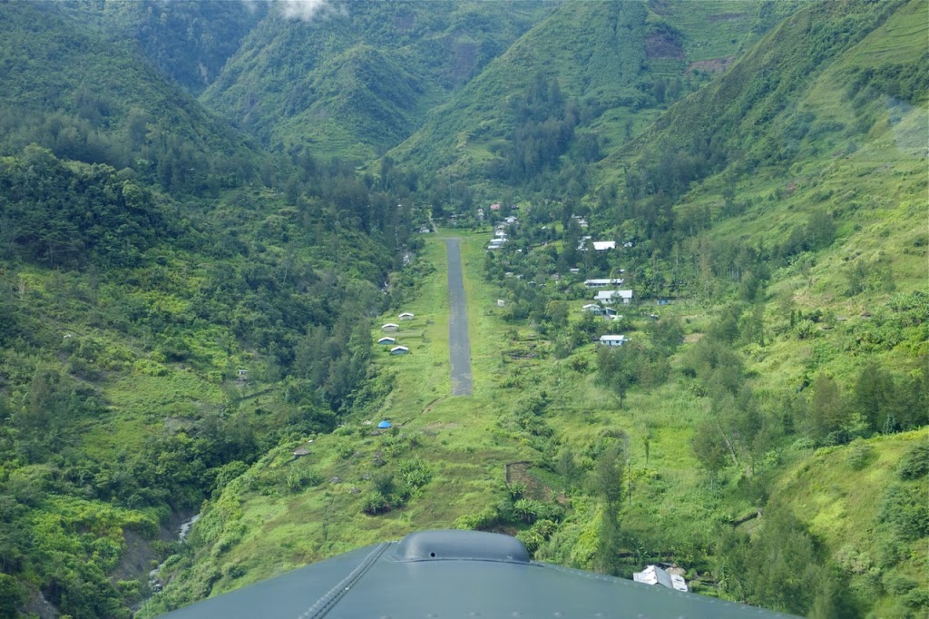 |
| Approach into Beoga |
Up until short finals, you can execute a go-around by turning out of the Beoga valley and into the main valley for another attempt. Due to the surrounding sloping terrain, it’s very easy to be high on approach as your normal perspective is thrown. I like to use the small collection of houses on the northern side of the main valley as a reference for the approach; if you’re a couple of hundred feet above them, you’ll be nicely setup for straight final approach (caveat – the Porter prefers a steep approach path, other aircraft may require a more curved, lower approach path).
Departure is simply a matter of turning out left or right depending on where you want to go next; left to climb along the main valley back up towards the south west and Timika, or right to follow the valley to the east towards Wangbe or Ilaga.
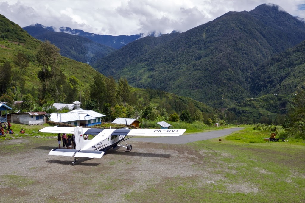
Within the last few months, the runway surface was upgraded. Originally it had a short section of tarmac on the touchdown zone at the bottom of the airstrip and grass for the rest. It currently has a fairly smooth compacted gravel surface which provides excellent braking action in all conditions (not that there was any problems with the previous, mainly grass surface. It’s also amazingly flat with barely any undulations, so it is much easier to control the Porter on the roll-out with barely any rudder inputs required.
 |
| Older photo of the original grass runway at Beoga |
Everything written in this article are opinions of the author and should not be taken as sole reference for attempting a flight into or out of the aforementioned airstrip.
Discover more from Matt Dearden
Subscribe to get the latest posts sent to your email.