 |
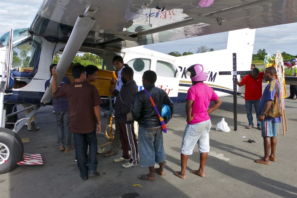
| Loading up one of the deceased in Nabire, Papua |
And that’s were we, along with other local operators, step in. I flew a couple of the deceased and their families in two separate trips, from Nabire to Moanamani which is about 50nm south east of Nabire. It was very sad to see the genuine despair amongst many of the villagers who were rolling around on the floor in fits of tears at the sight of the coffins being carried from the aircraft into the awaiting hearses. It’s all rather sad that a simple sporting event had turned into a mass riot/stampede resulting in deaths and injuries.
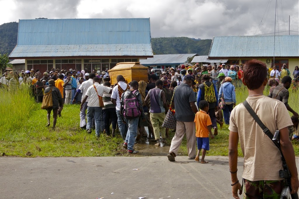 |
| Taking the deceased back home to Moanamani, Papua |
Aside from the boxing match tragedy, it’s been business as normal here in Nabire. The weather is being a little less cooperative with a lot more rain and cloud each day. That means a lot more flying around in IMC (instrument meteorological conditions – i.e. clouds) en-route, following known safe tracks and altitudes. It’s not as enjoyable flying around without being able to see anything outside but it does sharpen up one’s instrument flying skills. Of course you need to be visual to actually land and usually there’s plenty of holes in the clouds to allow safe, visual approaches to be made.
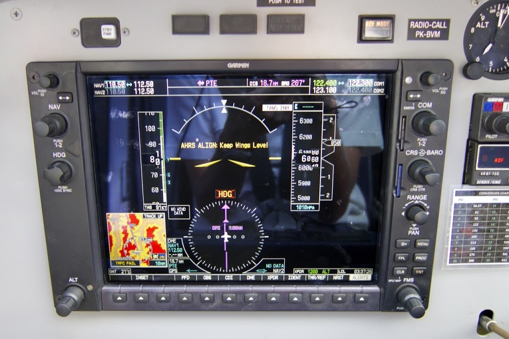 |
| AHRS failure, Garmin G950 |
All our Papua based Pilatus Porters have the latest Garmin G950 glass cockpit instrumentation. On the whole it has made flying a little bit safer with more a accurate terrain database, traffic avoidance system and a better weather radar. Being all electronic, we do have three, small back-up instruments should something goes wrong with main system – an altimeter, airspeed indicator and artificial horizon. These instruments will allow you to maintain flight in IMC but you obviously then have no ability to know where exactly you are if you can’t see outside. Therefore, getting visual is the first priority. Climbing on your current heading is usually the safest option if this should happen but an awareness of where all the high terrain is at all times is essential.
The above photo was taken in visual conditions after a rather bumpy airstrip departure caused the AHRS unit to go offline (along with a number of other systems) – not an uncommon occurrence but does fix itself after a minute or two.
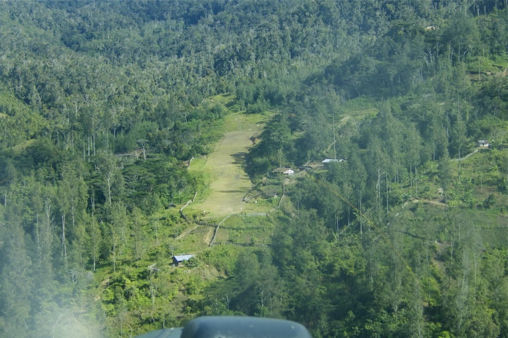 |
| Final approach, Zombandoga, Papau |
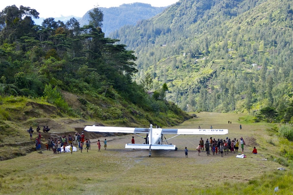 |
| Zombandoga, Papua |
When the weather has been nice, I’ve been enjoying flying into one of the newest airstrips from the Nabire area, Zombandoga. It’s 320m at around 6250ft and very well constructed with good drainage and a reasonably firm surface allowing decent braking performance. Great stuff!
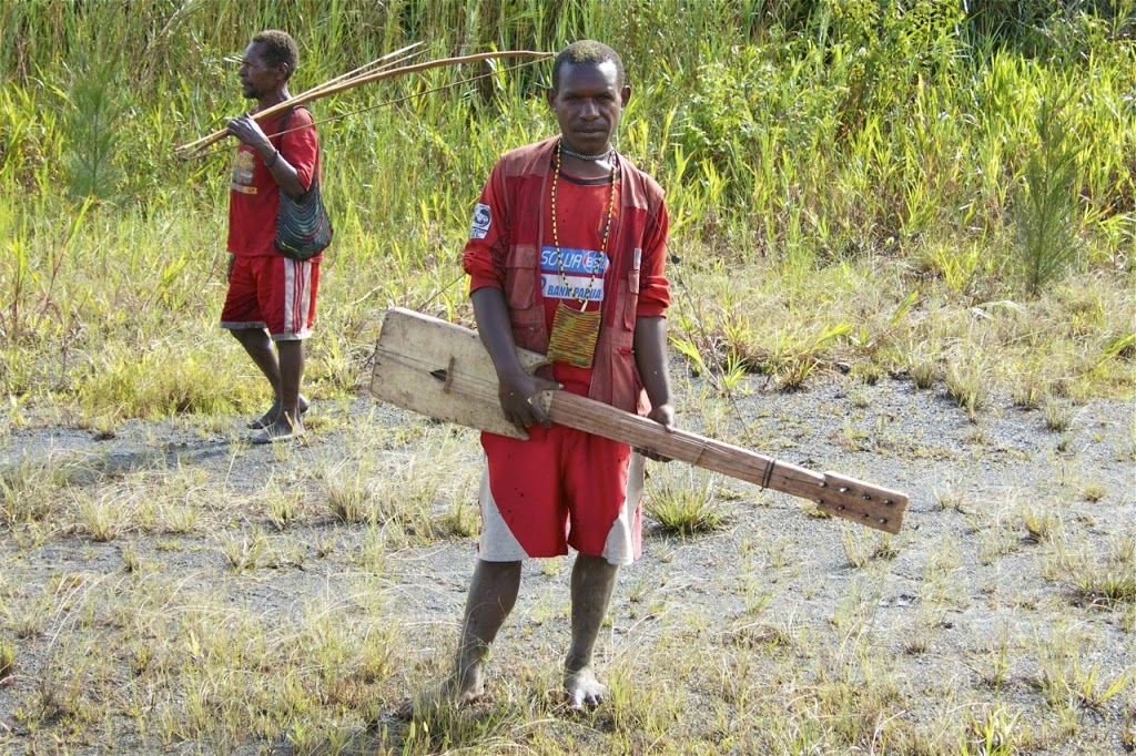 |
| Local with home-made guitar, Bilai, Papua |
I’ll leave you with this photo of one of the Bilai local’s home made guitar. He seemed a bit too shy to play it but this little village is always full of creativity including the PAC-750 trailer cover.
Discover more from Matt Dearden
Subscribe to get the latest posts sent to your email.
The track you use when flying on the IMC, is it already plotted by the company and then saved it on the avionic database or it just simply the previous track you or other fellow pilots who had flying to the destination during previous VMC flight ?
We have set tracks saved in our GPS database in each aircraft for continued IMC flight. These have been tried and tested over many years by our pilots flying these routes daily. Before any pilot first flies these tracks in IMC, they will always check them many times visually to ensure safe altitude and lateral distance from terrain.
On the whole we don’t spend that much time flying in IMC but when you have to, these tracks are much safer than trying to scud run under the clouds with rising terrain.
The guy with the custom guitar is wearing a Persipura jersey, the Papuan team from Jayapura. They’ve got a reputation of almost being almost undefeated at home. Maybe all their opponents got tired after all that red eye flights!
I gather the Papuan’s are amongst Indonesia’s best football players. And those red-eye flights never get any easier…